
The Complete Guide to Bernal Heights, San Francisco: Neighborhood Overview
Key Takeaways
- Geography: A large, distinct San Francisco neighborhood divided into the North, South, West, and East Slopes, plus the St. Mary’s area.
- Housing: Primarily single-family homes with private yards, popular with commuters due to immediate Interstate 101 and 280 access.
- Public Transit: Exceptionally well-connected by SFMTA Muni bus lines (23, 24, 67) and proximity to BART stations (24th St. Mission and Glen Park).
- Top Amenities: Features Cortland Avenue’s local shopping, the historic Alemany Farmers’ Market, and premier urban green spaces like Bernal Hill.
Understanding Bernal Heights Geography and Micro-Neighborhoods
Bernal Heights is a prominent hilltop neighborhood in San Francisco’s southern tier. Because of its size and unique topography, it is generally divided into several distinct slopes and micro-pockets:
- The North Slope: Facing the Mission District, known for sunnier weather and easy access to Precita Park.
- The South Slope: Overlooking the Interstate 280 corridor, offering views of the valley and direct access to transit.
- The West Slope: Bordering Mission Street, featuring steep hills and proximity to the La Lengua area.
- The East Slope: Sloping down toward Bayshore Boulevard and Interstate 101.
- St. Mary’s Pocket & Southwest Corner: A distinct residential enclave anchored by major recreational facilities.
Frequently Asked Questions About Bernal Heights
What is the housing market like in Bernal Heights?
Bernal Heights is unique in San Francisco because its real estate inventory is predominantly single-family homes, many with private backyards. The neighborhood also features multi-unit apartment buildings and traditional San Francisco “in-law” units (garden- or basement-level apartments with separate entrances).
The area is highly sought after by professionals commuting to downtown San Francisco, the East Bay, or Silicon Valley due to its central location and immediate highway access.
How easy is commuting and transit from Bernal Heights?
Bernal Heights offers some of the most efficient highway logistics in the city. Interstate 101 borders the neighborhood to the east, and Interstate 280 runs along the south. Major city arterials like Mission Street and Cesar Chavez Street provide direct routes across town, though they experience typical peak-hour congestion.
For cyclists, the neighborhood is highly bike-friendly; riding down the hill provides a seamless commute to the flatter parts of the city, though the return trip requires tackling a steady incline.
Public Transportation Options:
-
- Muni Bus Line 23: Connects the Bayview to the SF Zoo via Crescent Avenue, making a direct stop at the Glen Park BART Station for easy regional transit access.
- Muni Bus Line 24: Runs from Pacific Heights through the Castro and Noe Valley, traversing the entire length of Cortland Avenue before ending at Bayshore Boulevard.
- Muni Bus Line 67: Circles the southernmost streets of the neighborhood and travels north along Folsom Street straight to the 24th Street Mission BART Station.
Where are the best places to shop and eat in Bernal Heights?
The neighborhood’s commercial heartbeat is Cortland Avenue. This walkable commercial strip features a dense collection of independent businesses, boutiques, and highly rated culinary spots.
Top Restaurants and Cafes on Cortland Avenue:
-
- Dining Favorites: 3rd Cousin (California farm-to-table), Moki’s Sushi and Pacific Grill, and Vega Pizzeria.
- Coffee & Pastries: Pinhole Coffee, Martha & Bros. Coffee, and Progressive Grounds.
- Grocery Stores: The Good Life Grocery serves as the primary neighborhood market, offering a full butcher counter, fresh produce, and daily staples.
The Alemany Farmers’ Market
Located at 100 Alemany Boulevard, the historic Alemany Farmers’ Market operates every Saturday from 6:00 AM to 2:00 PM. Known as “the people’s market,” it features an extensive, affordable selection of regional fruits, vegetables, flowers, and nursery plants, along with prepared-food vendors serving fresh hummus, empanadas, pastries, and hot coffee.
What parks and recreational spaces are in Bernal Heights?
The neighborhood is famous for its abundant, well-maintained green spaces, each catering to different outdoor activities:
-
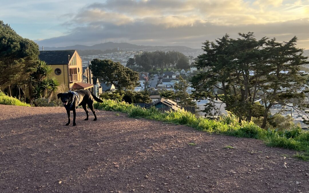
- Bernal Hill (Bernal Heights Park): Located at the geographic center of the neighborhood, this massive urban hilltop is celebrated as a premier off-leash dog park. It features rugged hiking trails and uncompromised 360-degree panoramic views of the entire Bay Area.
- Precita Park: A long, grassy rectangular park on the North Slope. It features a modern children’s playground and sits adjacent to neighborhood cafes. It serves as a popular gathering spot for families on sunny afternoons.
- Holly Park: A circular park located on the East Slope, featuring a small baseball diamond for youth sports at the summit, walking paths, and quiet picnic areas.
- St. Mary’s Park and Recreation Center: Situated in the southwestern corner, this expansive community complex features an indoor gymnasium, athletic fields, tennis courts, basketball courts, a playground, and a large, dedicated dog play area.
- Bernal Heights Rec Center: Located behind the library. The Plaza is a family-friendly community space, and the Rec Center offers basketball courts and other activities.
What schools serve the Bernal Heights neighborhood?
Families in Bernal Heights have access to both public schools managed by the San Francisco Unified School District (SFUSD) and reputable private institutions:
-
- Paul Revere K-8 School: A public school serving families on the South Slope.
- Junipero Serra Elementary School: A public neighborhood elementary school located near Holly Park.
- St. Anthony Immaculate Conception School: A private Catholic school located on the North Slope bordering the Mission District.
A Parent&’s Guide to Education & Childcare in Bernal Heights
Follow us on Instagram – Bernal Connect
Author: Mike Doherty: Bernal Connect
Mike Doherty serves as Chief Experience Officer at Greening Projects, a nonprofit organization dedicated to transforming underutilized urban spaces into vibrant green areas that benefit communities and the environment.
